Este website utiliza cookies. Ao continuar a navegação está a aceitar a sua utilização.
Caso pretenda saber mais, consulte a nossa política de privacidade.
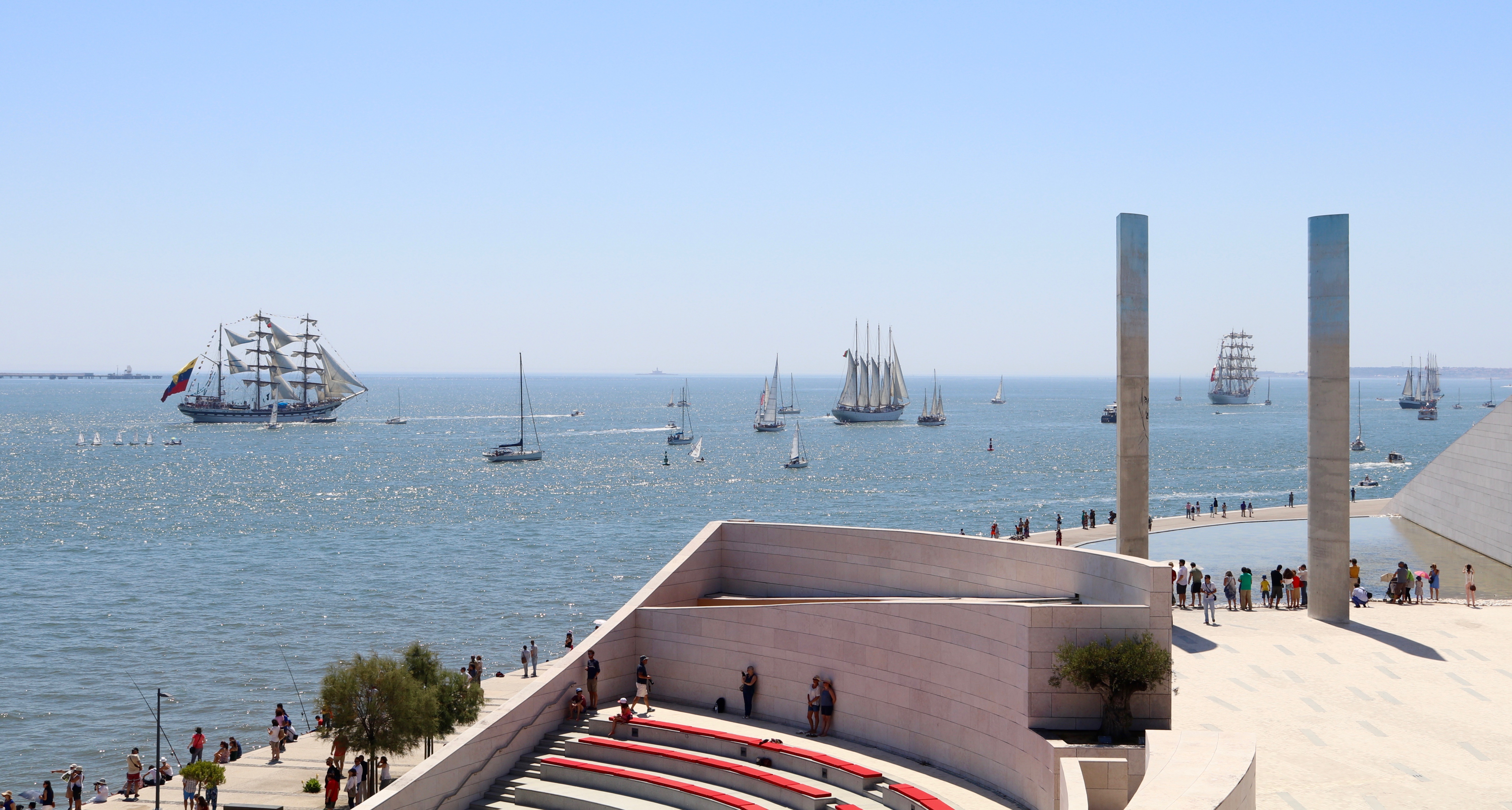
Knowing more about the port and its ways, facilitates the understanding of its importance as a city´s partner. Here you can get to know our port.
Do to the importance of keeping citizen informed about the leisure events and areas on the riverfront, a set of information is available that contributes to their better use.
In this link you can also find the Regulations for the Licensing of Construction Works of the Port of Lisbon - RLOPL, as well as the necessary forms for the instruction of the administrative licensing processes, of the interventions to be carried out in our jurisdictional area.
Riverside cycle ways
The “Ciclovia do Mar” built by the Port of Lisbon Administration aims to continue an existing cycle path. This new bike path is part of the “Ocean Campus” project area, which results off a partnership between APL, and to Municipalities: Lisbon and Oeiras.
This 3.34km bike path runs along the sea promenade between the beaches of Torre and Paço d’Arcos.
It is an enchanting tour along the Oeiras wall, shared by pedestrians and, in a specific usage schedule, bicycles.
The bike path passes through the Recreational Port, the Oceanic Pool, INATEL Oeiras Hostel Complex and the Youth Hostel of Catalazete. It crosses several beaches, such as Torre, Santo Amaro de Oeiras and Paço de Arcos, ending at the Clube Náutico de Paço d’Arcos.
The bike path runs along the riverside between Oeiras and Paço de Arcos, accompanying the beach line.
The flooring is in bituminous painted red with vertical signage. It is practically flat tour, without slopes and with a Low degree of difficulty.
Over the past few years, The Municipality of Loures has put on course a project of smooth mobility, resulting in the creation of a pedestrian and cycling route, along the Tagus River embankment, to connect the municipalities of Vila Franca de Xira, Loures and Lisbon. The Project is called Frente Ribeirinha de Loures, wich stands for Loures Riverside.
This new 6.500 meters pedestrian and cycle path will assure the population's access to the banks of the Tagus River, allowing the enjoyment of the landscape of its estuary, the contact with Nature, and at the same time, smoothly connect to two neighboring counties.
In 2011 the Municipality had already built a first 700m track of this Riverfront, which connected the Passeio dos Heróis do Mar to the mouth of the Trancão River and the city of Lisbon.
More recently, on July 23, 2017, the second pedestrian and cycling route, that will connect Vila Franca de Xira to Lisbon, was inaugurated. This 700 meter path allow you to cycle from Santa Iria de Azóia Train Station to the pontoon, on the bank of the Tagus River.
Soon, the 6.2-kilometer work will proceed along the waterfront, from Santa Iria to the Trancão river.
The 6.2 kilometers of cycle path within the municipality of Loures will be built of wooden-Flooring, always above sea level. This walkway solution adopted by the Municipality, are intend to “not interfere with the choupal” existing on the riverbank.
This last work is part of an already announced plan of the creation of a 44.5 km cycle path that connects Vila Franca de Xira, Loures’s Riversides, in areas that are under the Port of Lisbon Jurisdiction.
The bike path between Alhandra and Vila Franca. de Xira is part of the Riverside Pedestrian Path created by the Vila Franca de Xira City Council under the Polis Program.
With 4 meters width, the tour extends along the Tagus River, always in a moth and flat way. All it´s extension is within the jurisdiction of the Port of Lisbon.
A large part of the promenade is an embankment. In total, the Promenade is about 3.3 km long, allowing the population to enjoy the riverside, whether it is for leisure or for sport, pedestrian walks, bicycle tours or simply enjoying the generous living areas.
This is 2.800mm double way bike path, meaning, it has a route that runs from the Tagus river area, in Cacilhas, just outside the boat terminal in Largo Alfredo Dinis, and then extends to the interior of Parque da Paz. Then, it turns into another symmetrical hypothesis, with few parts common to the previous one. This double route begins precisely at Largo dos Cacilheiros, in Cacilhas, and extends along Avenida Aliança Povo - M.F.A. (first in the parking lot and then in an exclusive side lane for bicycles), and extends along Avenida António José Gomes and Largo 5 de Outubro, where it joins the pedestrian circulation. On Brejo Road, it has an exclusive circulation area again. Before going inside the Parque da Paz, it still passes through a light signaling zone, crossing the end of the IC 20 road.
The return from Parque da Paz (roundabout in the south center), to the bota terminal (Cacilheiros), is made on parallel markings to those of the reverse route.
This Bike Path is part of the Parque Ribeirinho de Amora. It was idealized as a leisure route, along the riverside of Baía do Seixal and has a total length of 699 meters.
The Parque Ribeirinho follows the waterfront, offering great views of Seixal Bay, over the Tagus River. The Park also has gardens, contemplation and relaxation areas, but also several terraces and restaurants in the old town of Amora, always overlooking the bay.
The bike path is fully integrated in the Parque Ribeirinho, between the Bay of Seixal and the old town of Amora. The floor is made of porous concrete, with horizontal signs painted in white, and its course is mostly flat.
This is another of the two routes that make up the Passeio Ribeirinho Bike Path of the Seixal Bay. It was built as a leisure route along the East Riverside of the Bay, from Arrentela to Seixal, in a 2.34Km path always parallel to Avenida República.
Along the entire route, you can enjoy the proximity to the Seixal bay. Along the way, you will find Places of Interest such as Quinta da Fidalga and the 2 sites of the Municipal Ecomuseum: the Naval Center of Arrentela and Mundet (Seixal), along with several sculptures by the riverside and the Seixal Cultural Forum.
In addition, you can visit the picturesque old towns of Arrentela and Seixal, where you will find other points of interest such as religious heritage or Popular Typography.
There are small sections where the cycle path is distinguished by the design of the pavement, but in general it is a mixed routed with pedestrian’s walks.
The floor is made of porous concrete or concrete blocks. It features vertical signage and information panels.
The Amora and Arrentela-Seixal cycle paths are two routes on the same riverside promenade. These sections will be joined halfway, completing the Passeio Ribeirinho Cycle Path of Seixal Bay, as an uninterrupted corridor with almost 4 kilometers.
The Parque Ribeirinho Augusto Cabrita is located in the Tagus River embankment in Barreiro area, where the former Praia da Bela Vista was previously located. It is a marvelous 740m Tagus River balcony, that offers an excellent panoramic view to the other bank, the 25 de Abril Bridge and Vasco da Gama Bridge, namely over the Mar da Palha.
The Bike Path, one of the features offered by this Park, has a dual functionality of mobility and recreation. It crosses the entire leisure area, always parallel and next to the river, from the industrial area of Quimiparque to the boiler of Moinho de Maré do Braancamp.
In addition to the Bike Path, Avenida Bento Gonçalves Park features several green spaces, the Augusto Cabrita Walk, walking paths, Grasse areas, spaces for rest and contemplation, outdoor playgrounds, geriatric park, swimming pool, sailing club, picnic area, children's playground and Jim's Eco-Moinho (Eco-windmill).
Right next to it, at the mouth of the Coina River, you can contemplate the various existing Wind and Tide Mills.
The bike path is fully integrated in the green area of the Parque Ribeirinho Augusto Cabrita, on the Tagus River embankment next to the mouth of the Coina River.
The floor is in bituminous colored "Neoasfalto" dark red, with an average width of 2.5 m, which allows circulation in both directions. The vertical and horizontal signaling elements, which are considered essential for the safe use of this infrastructure, are permanently taken care of. The bike path develops next to the river in all its extension, it has no slopes, which means it is mostly flat.
The Bike Path runs parallel to Avenida da Liberdade, on Coina’s riverside. It connects the Green Area of Polis to the Multipurpose Terminal of Barreiro, thus allowing a safe connection from this area of the city to the Multimodal Terminal, with the landscape and the riverside breeze as a company. This bike path is 1.080 meters long.
On the south side, the bike path begins at the Parque Recreativo da Cidade - Zona Ribeirinha do Coina. It is a new leisure space of high environmental and landscape interest that aims to connect the city to the river. It has, among other things, a large green area, an open-air amphitheater, a children's playground and the recovered Caldeira do Alemão.
Very close by you can find the City Park and the Augusto Cabrita Municipal Auditorium.
With an average width of 3.5 meters, it allows you walke at will in both directions. The bike path is properly signposted, both Horzontal and vertically. The Flooring is in colored bituminous material, Neoasfalt red. It always develops next to the river, so it has no slope, being practically flat.
This Bike Path, which starts at the intersection of Rua Alexandre Herculano, runs practically across the Eça de Queirós Street, ending next to the access to The River Beach of Rosário and has a length of 0,945km.
The entire road is properly signposted, with vertical elements and floor markings, over a red bituminous finishing.
It is one of the cycling routes that intends to connect urban centers to leisure areas, in particular, to the River Beach of Rosário on the Tagus River.
This 1.68Km Path starts in the Parish of Moita and runs along Rua Luís de Camões and the Tagus River embankment until it ends next to Praia’s Bike Path.
With mixed floors, between asphalt in the urban area and gravel on the riverside, it is also duly signposted.
This Path develops within the urban arrangement of Avenida da Marginal.
With just over 400m, this cycle path runs along the promenade between the pier and the Health Center.
The bike path is built in a bituminous floor painted in red.
This bike path runs along the EN 11, connecting the riverside area of Alhos Vedros to the Parque Urbano da Moita, in Baixa da Banheira.
The main feature of this Bike Path is the interconnection between places of public interest, such as Parque das Salinas and Moinho de Marés (Tide Mill) with the Municipal Urban Park.
The route is inserted in EN 11, bounded by a red bituminous floor.
This is a 405 meters length Pedestrian and cycling corridor that runs through the new dike, passes the bridge of Cais das Faluas and to Rua António Fortunato de Sousa.
Links
- Algés
- Bom Sucesso (EMEL)
- Santo Amaro Dock (Telpark)
- Alcântara Dock (Telpark)
- Santos (EMEL)
- Santa Apolónia (Telpark)
The European Maritime Safety Agency is based in Ribeira das Naus, Cais do Sodré in Lisbon.
The contract for the "Construction of the European Maritime Safety Agency Headquarters (EMSA) and also the European Monitoring Centre for Drugs and Drug Addiction (EMCDDA) as well as the Restoration of the Clock Building" was possible through a Protocol between the Government of the Portuguese Republic and the European Agencies.
The Architect Manuel Tainha was responsible for developing this Project. The European Agency headquarters and the Observatory are composed of three different buildings that form a central square facing the Tagus River. This complex and concept has contributed to the recovery and enhancement of this riverfront.
Under the square, you can find a car park with a total capacity of 218 places, as well as some services of the EMSA headquarters, CIEJE and the Auditorium.
The access to the car park is made by a parallel road to the river, located to the south of the complex, which connects with the Roque Gameiro Garden Square.
EMSA was set up in the aftermath of the Erika disaster in 1999 to help improve the overall maritime safety system within the Community by reducing the risk of maritime accidents, marine pollution caused by ships and the loss of human lives at sea.
In general terms, the Agency provides technical and scientific support to the Commission in the area of maritime safety and ship pollution prevention by developing and updating legislation and by monitoring its implementation and evaluating the effectiveness of measures, with the main objective of preventing future events. It cooperates closely with the maritime services of the Member States.
The Agency plays an active role in strengthening the inspection regime under Port State Control and in monitoring the classification societies recognized at a Community level, control and information for maritime traffic.
EMSA provides added value, through:
- Better control of ship construction;
- Better and more consistent inspections;
- Better traffic control;
- Adequate seafarers training;
- Combating Sea pollution;
- Take knowledge from past accidents and applying that new knowledge to prevent future incidents;
- Effective management of ship waste;
- More Effective Ship protection.
The Agency promotes cooperation between the Member States and disseminates best practices in the Community.